Portal, AZ - Rodeo, NM
Serving The Communities Of Portal and Rodeo (www.portal-rodeo.com)
Serving The Communities Of Portal and Rodeo (www.portal-rodeo.com)

Hiking
Jun 18 - Ida Peak Trail
Meet at the Silver Peak Trailhead at 8:00 a.m. AZ, 9:00 a.m. NM
Carol Simon (520) 558-2433 casimon1947@icloud.com
Elaine Moisan (520) 558-5204 emoisan2011@hotmail.com
Elly Van Gelderen (520) 558-3715 or ellyvangelderen@asu.edu
__________________________________________________________________________
Click On Any Image To See It In Its Original (Larger) Size
Next week, we plan to hike on a maintained trail! Meet at the Silver Peak trailhead at 8 AM AZ time, 9 AM NM to go up to the crest and hike the Ida Peak trail. Bring lunch, hat, lots of water and sun protection.
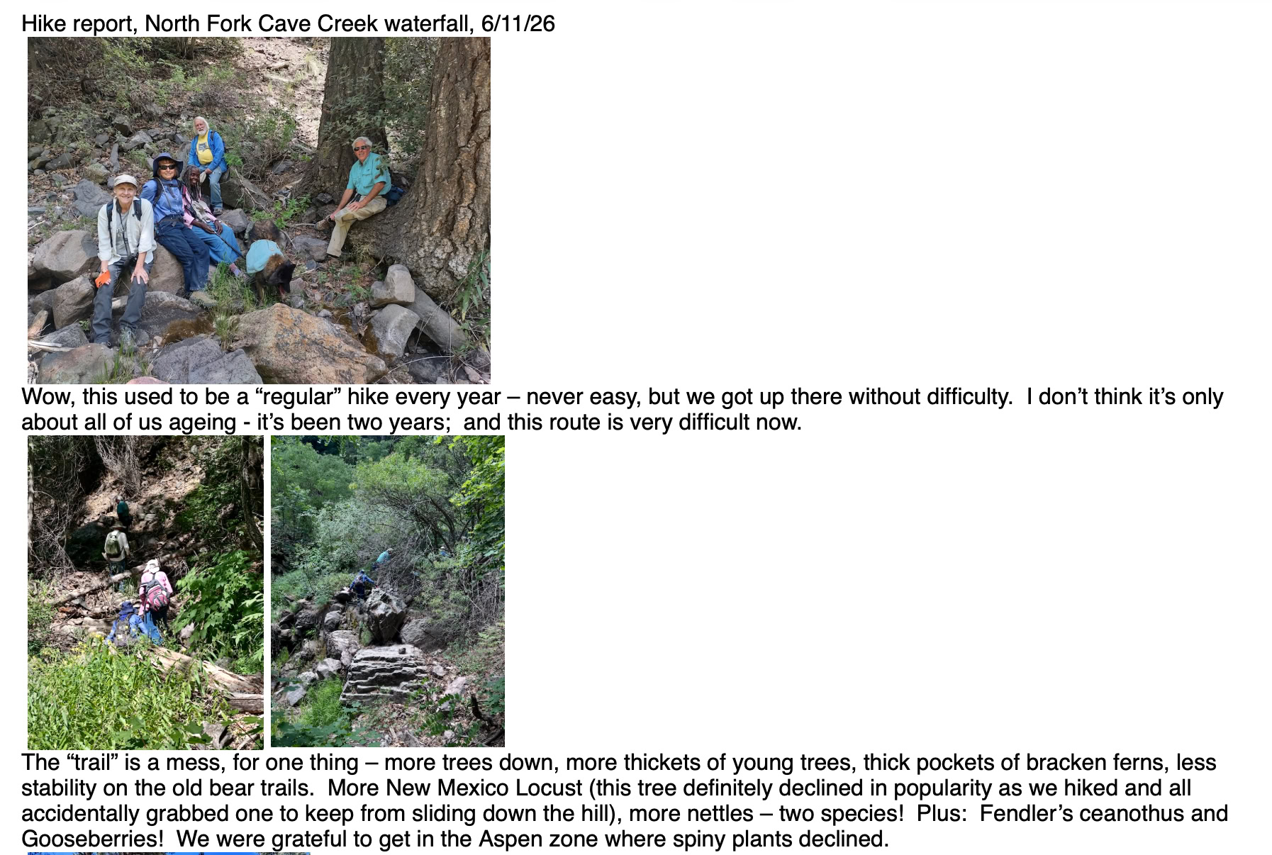
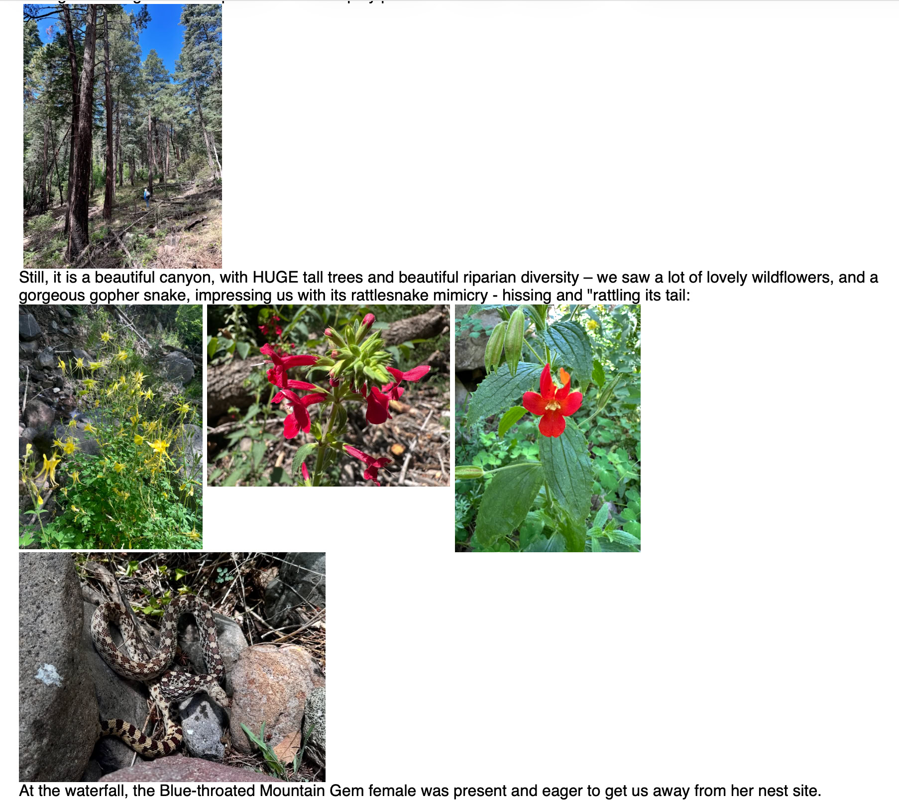
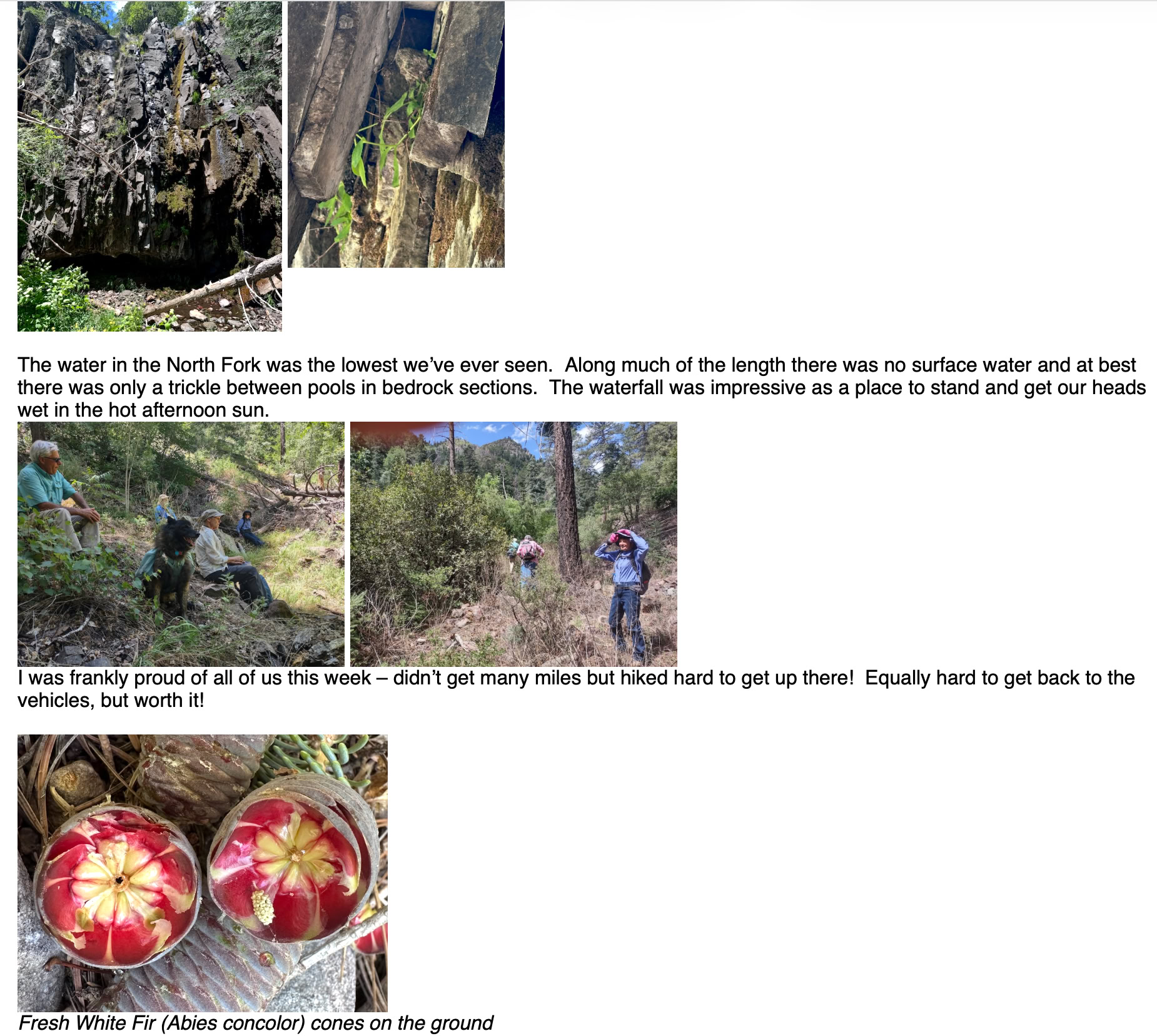
Hike report from Elaine & Al; photos from Rod & Elaine
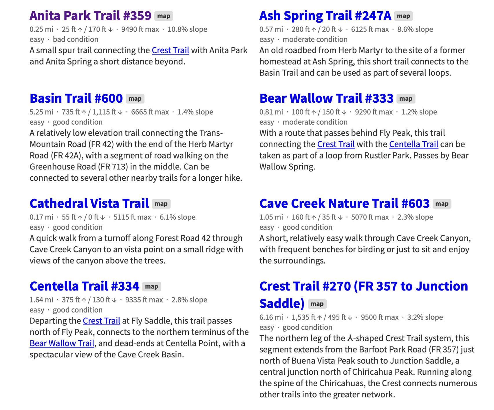
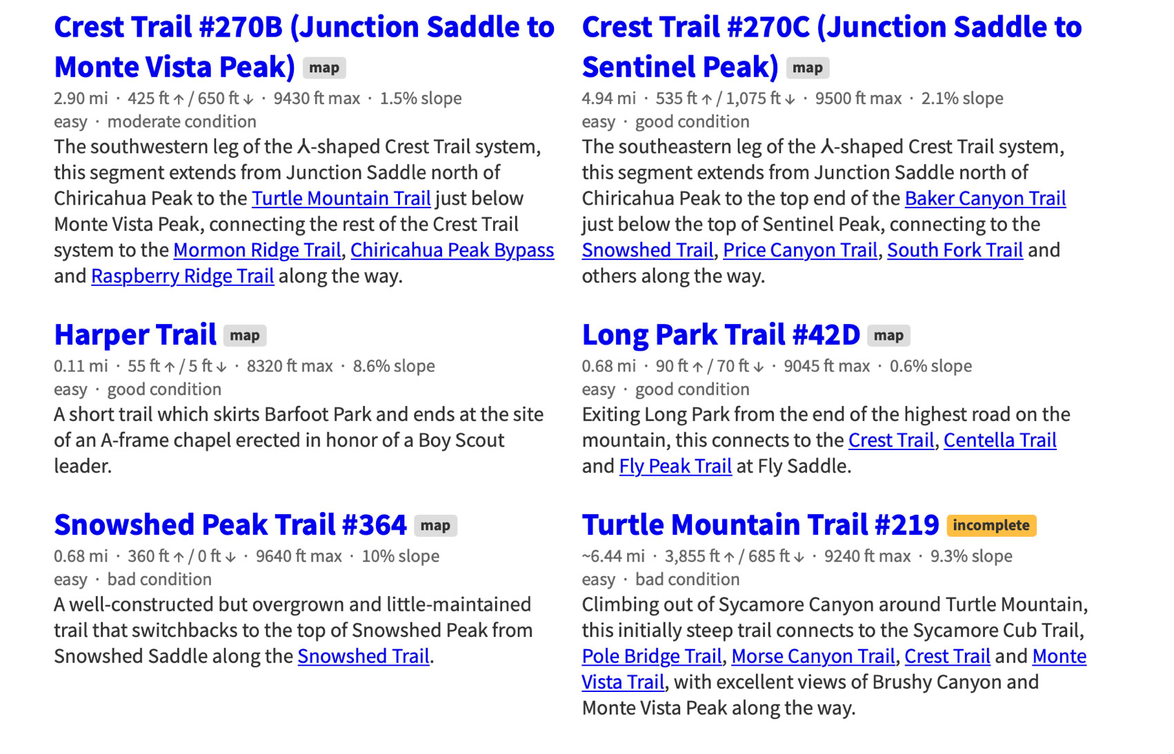
Easy Trails
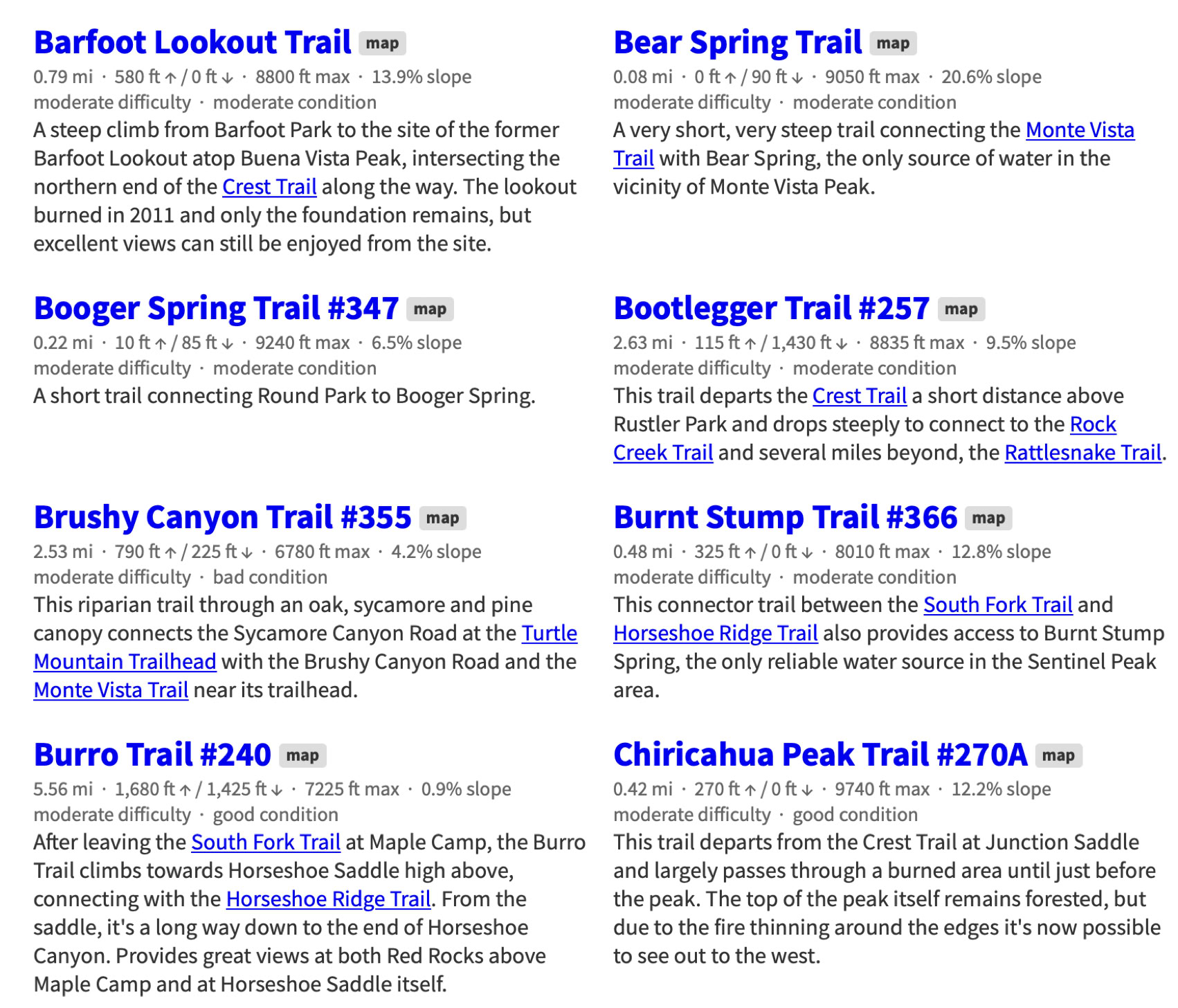
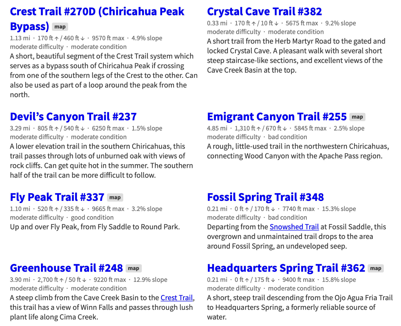
Moderate Trails
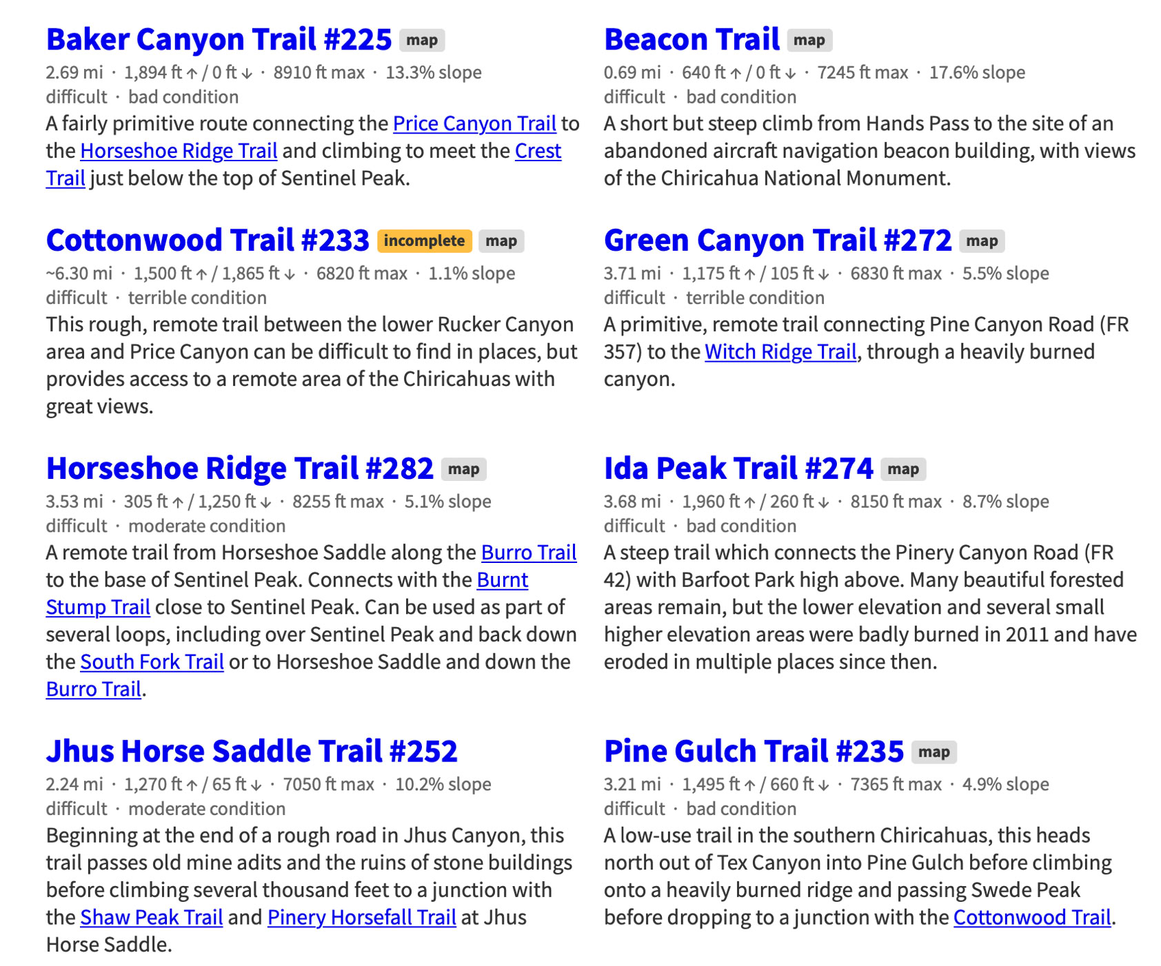
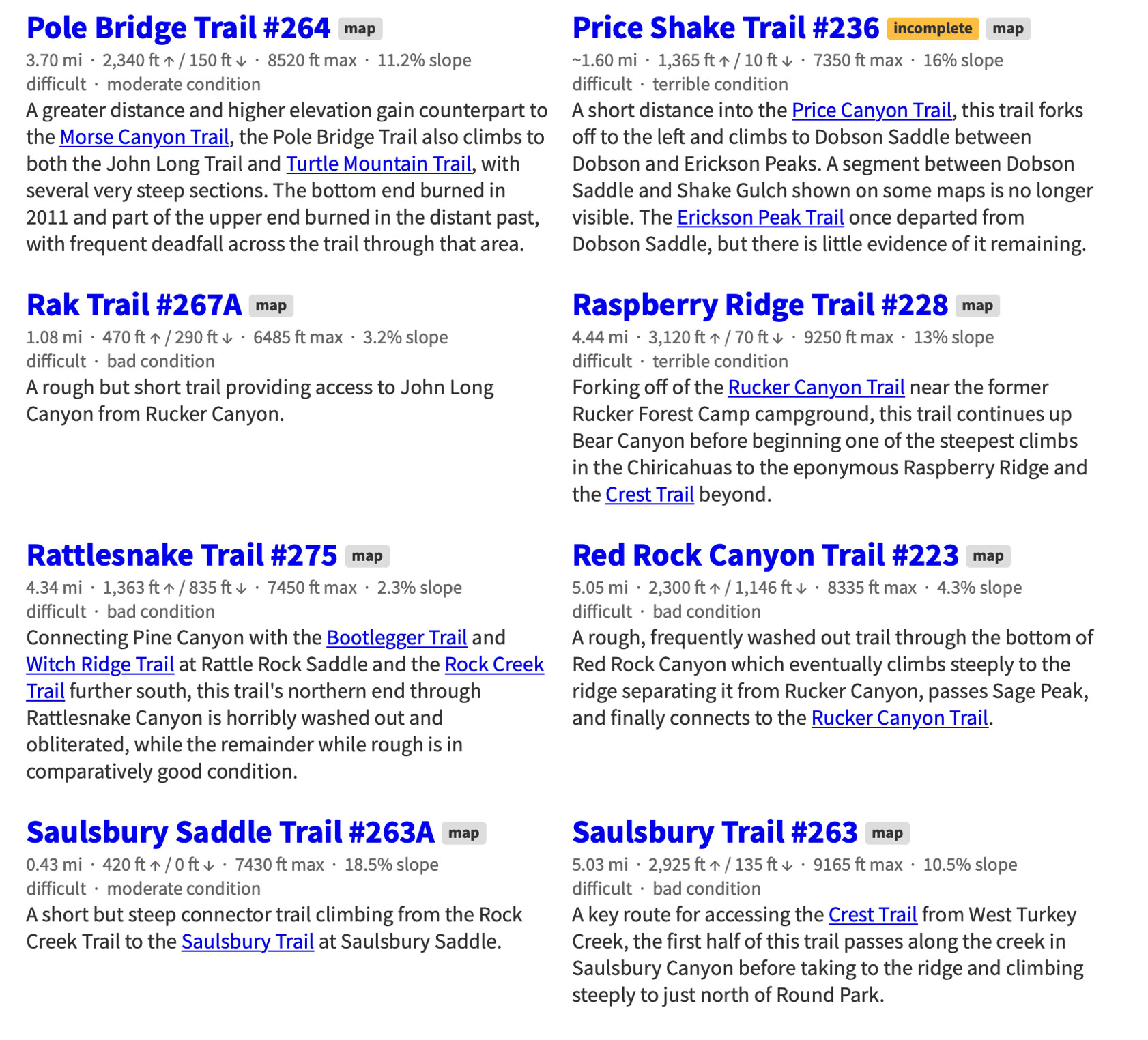
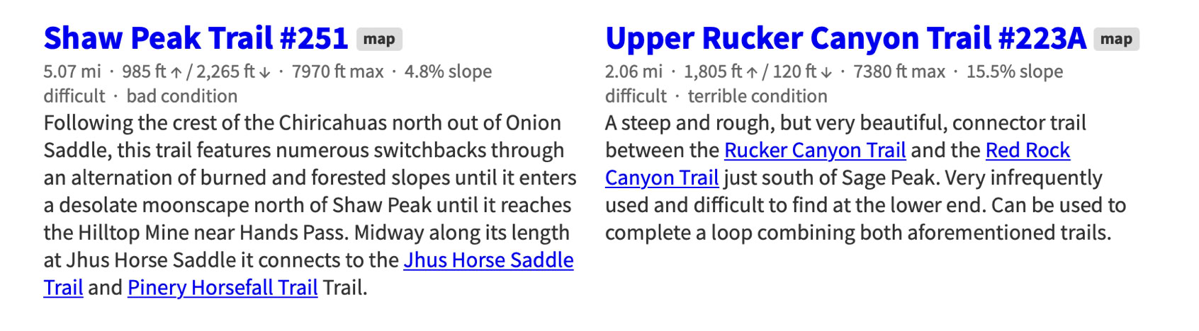
Difficult Trails
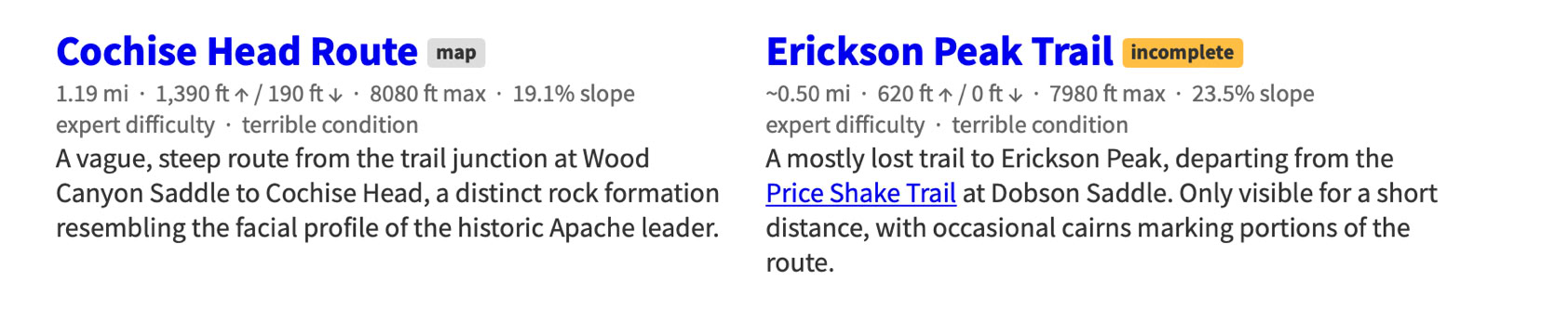
Expert Trails
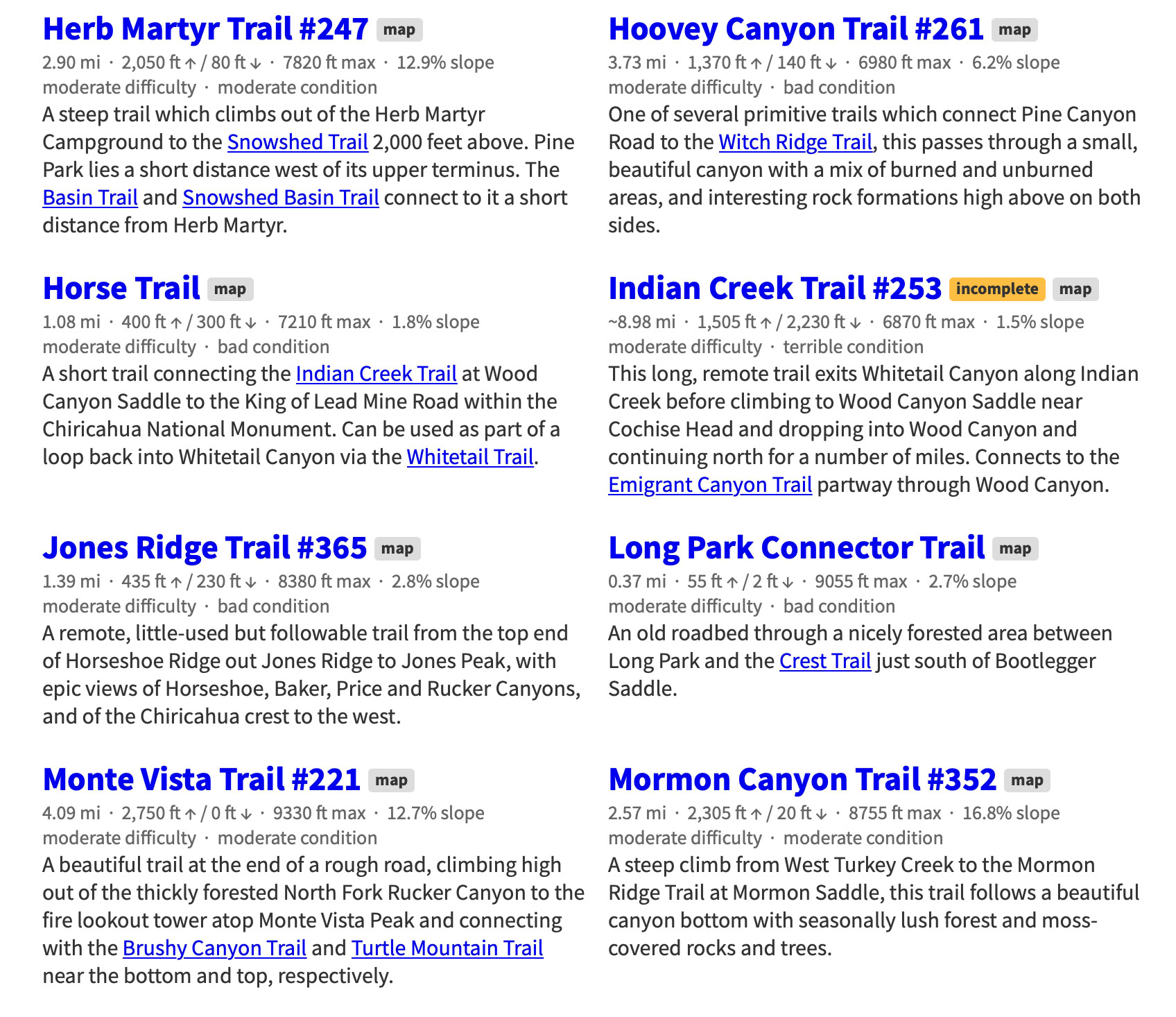
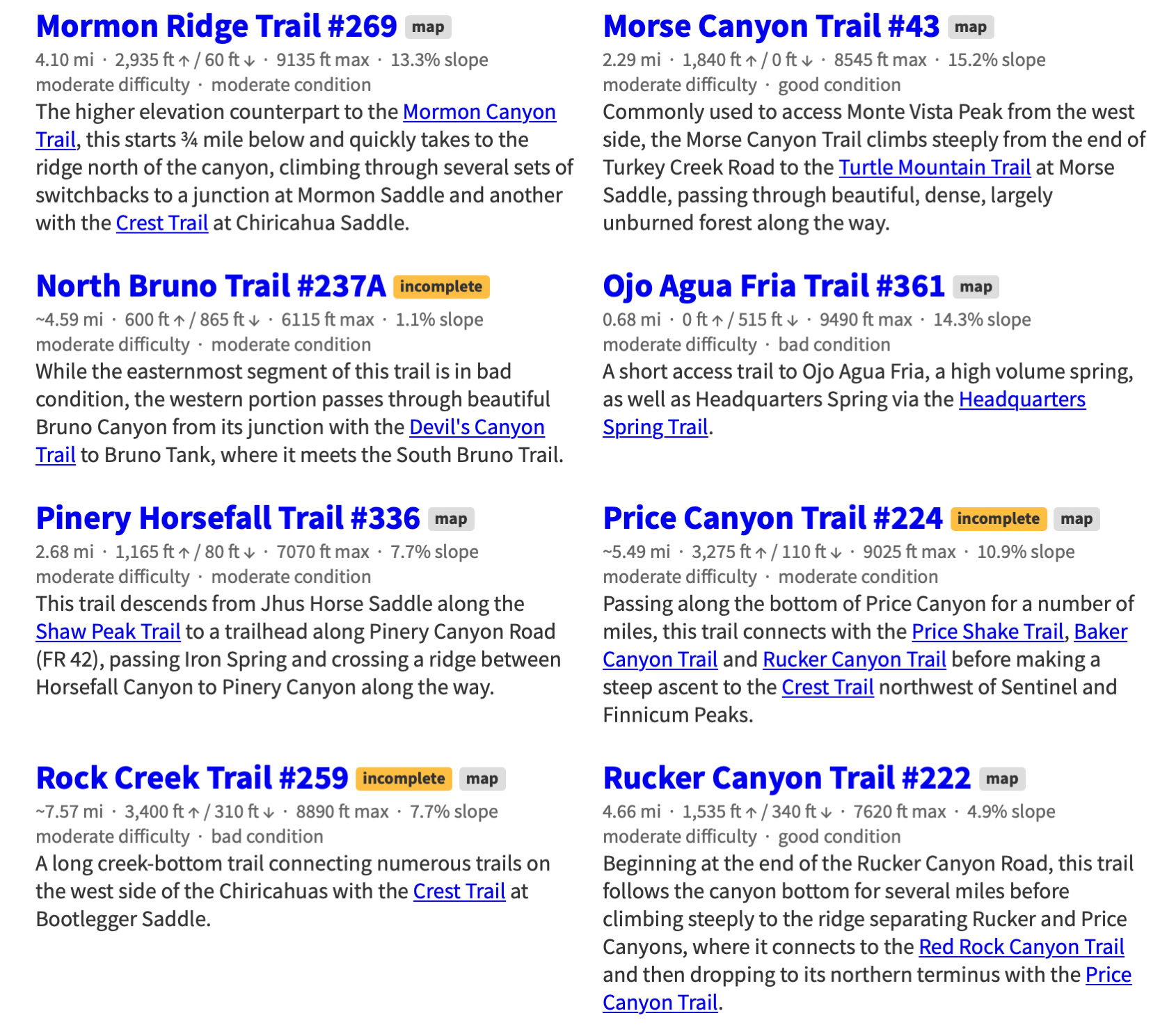
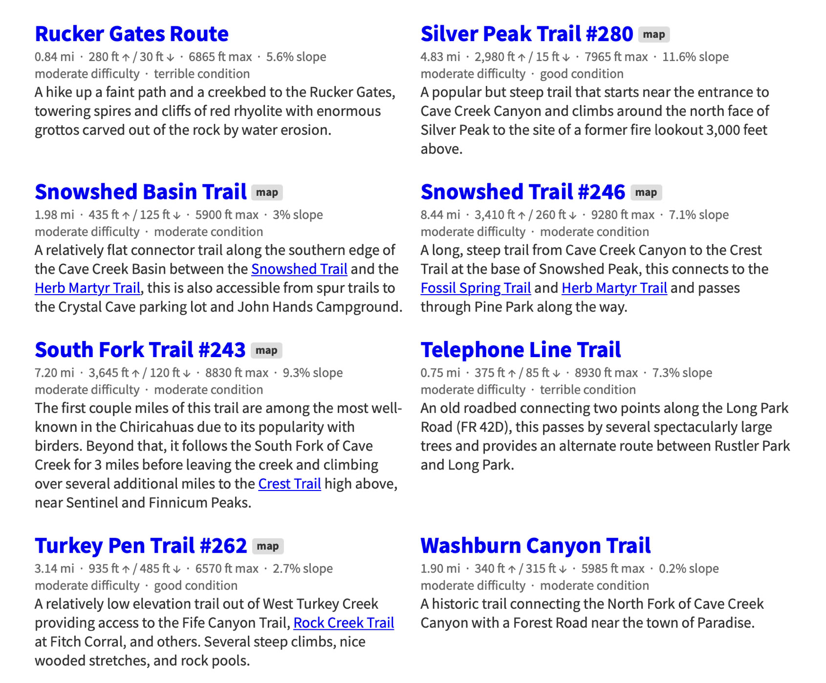
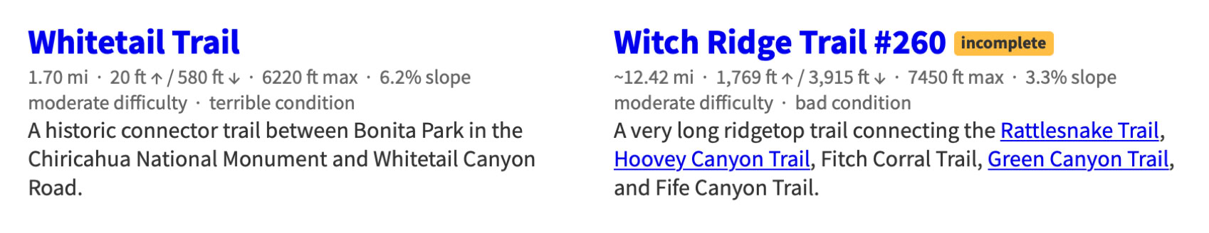
Chiricahua Mountain Hiking Trails
This project -a Herculean task - was started by Jonathan Patt as a collection of GPS data recorded while hiking in the Chiricahua Mountains of Southeastern Arizona starting in 2012 and expanded slowly into this site over a six month period beginning around 2013, during which it became obvious that much of the existing Chiricahua hiking information is out of date and, for some trails, nonexistent. This site is an attempt to resolve that problem.
If you would like to see a map of these trails or want more information about the project visit the Chiricahua Mountains Hiking Trails web site at:
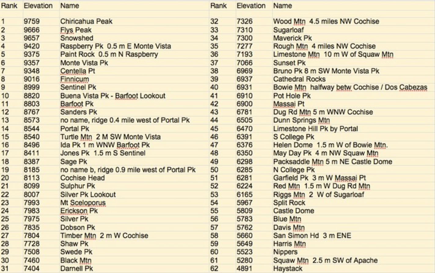
The 62 Highest Peaks, Mountains, Hills, And Lookouts In The Chiricahuas
(Tabulated by Ray Brooks)
(Form Necessary To Work With Trail Crew)
Download - Complete - Mail
To volunteer with the US Forest Service, fill out an application. If accepted, a Volunteer Service Agreement specifying the task(s) will be sent to you.
DOWNLOAD THE FORM. Print it, fill out, sign in block 23, and date. You can scan a signed document and e-mail it toArmando Arvizu at: armando.arvizu@usda.gov
You can also mail the form to Armando at the Douglas Ranger District Office:
1192 W. Saddle View Rd. Douglas, AZ 85607
People can join the list automatically by sending an email to portal-rodeo-hiking+subscribe@googlegroups.com and they should start receiving messages.